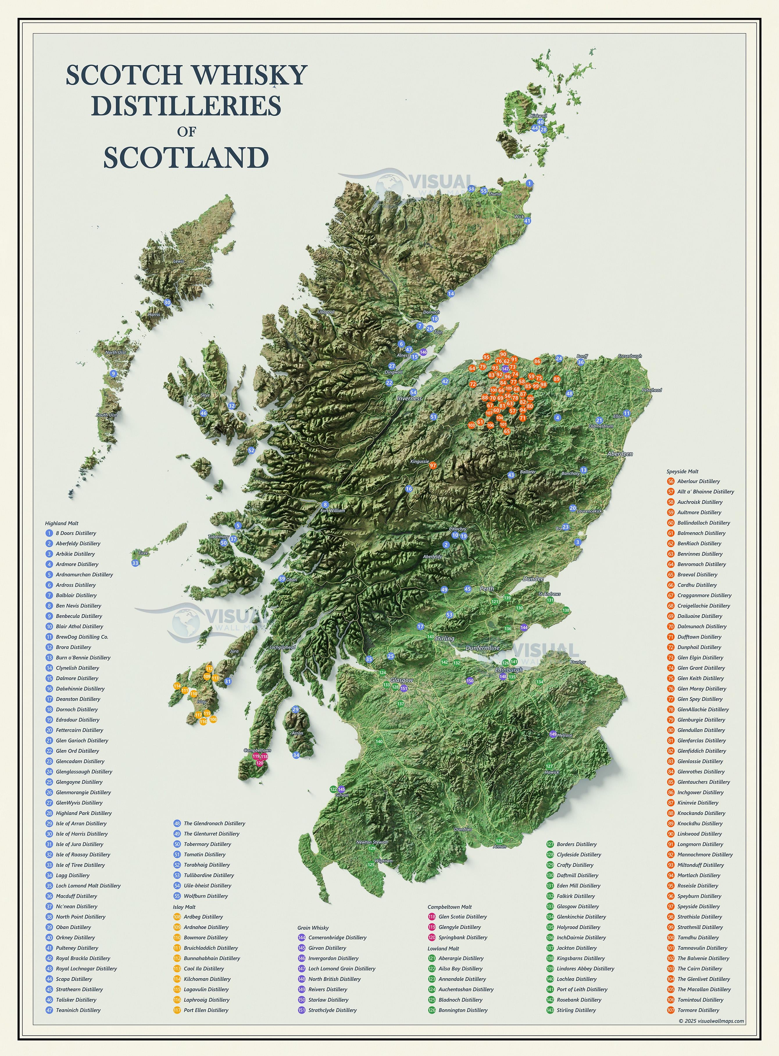
Description: I plotted the location of all the scotch whisky distilleries and identified their specific region/malt. Overlayed on top of sentinel-2 imagery with surface model data for shaded relief. Check out other examples on my [instagram](https://www.instagram.com/visualwallmaps)
funny_anime_animal on
That’s cool! My one suggestion would be to tone down the saturation on the map, the markers get lost in the colours 🙂
80percentlegs on
Blessed is the highland malt. My faves are few those dots north of Inverness.
Also Talisker: highland malt with a touch of the western smoke. Pure gold.
CaptainColdSteele on
I’m honestly a little surprised there’s only 107
Kiss_It_Goodbyeee on
Where’s Shetland?
macrolidesrule on
Glencadam is a good malt, my great great uncle used to work their back in the 70’s and 80’s.

![Scotch Distilleries of Scotland [OC]](https://www.byteseu.com/wp-content/uploads/2025/01/f59kpl16s2ge1-1133x1536.jpeg "Scotch Distilleries of Scotland [OC]")
7 Comments
Source: Copernicus DEM, Sentinel-2 satellite imagery, OSM Roads, Scotch Whisky Assoc.
Tools: Blender, QGIS, Global Mapper, Photoshop
Description: I plotted the location of all the scotch whisky distilleries and identified their specific region/malt. Overlayed on top of sentinel-2 imagery with surface model data for shaded relief. Check out other examples on my [instagram](https://www.instagram.com/visualwallmaps)
That’s cool! My one suggestion would be to tone down the saturation on the map, the markers get lost in the colours 🙂
Blessed is the highland malt. My faves are few those dots north of Inverness.
Also Talisker: highland malt with a touch of the western smoke. Pure gold.
I’m honestly a little surprised there’s only 107
Where’s Shetland?
Glencadam is a good malt, my great great uncle used to work their back in the 70’s and 80’s.
Finally a map I can follow