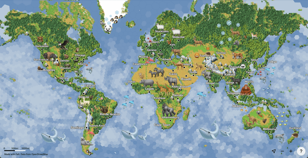
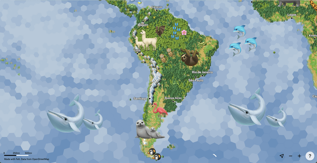
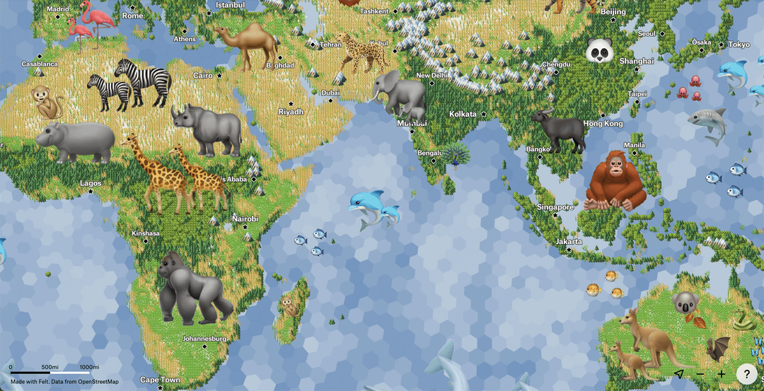
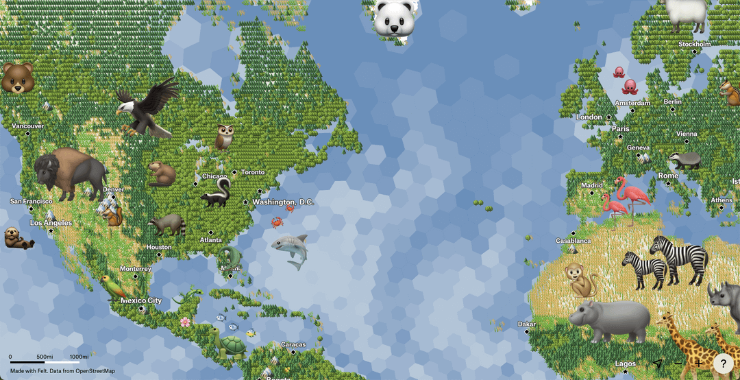
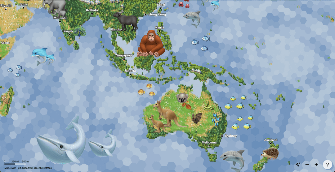
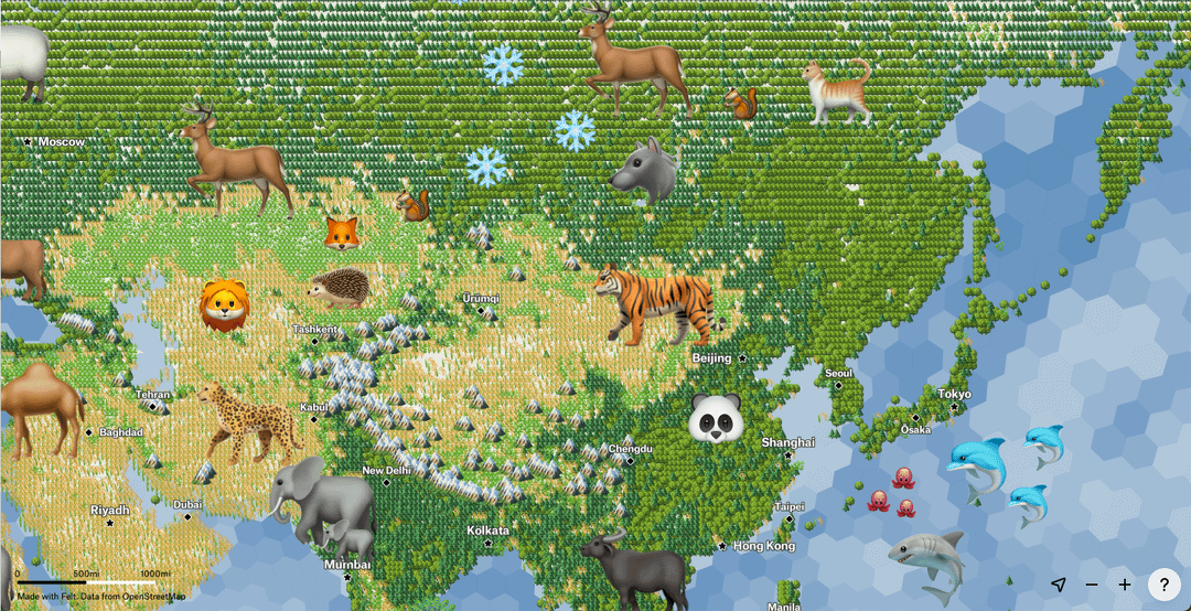
Share Facebook Twitter LinkedIn Pinterest Bluesky Threads [OC] The World as Emojis: A Wild and Leafy Adventure Posted by makella_
makella_ on February 19, 2025 11:46 pm I had such a good time making this wild world map with emojis and H3 binning! I hope you enjoy looking at all the details. Data: * NASA for NDVI and Bathymetry * OpenStreetMap for peaks and summits * animals were hand placed Map made with r/felt * Learn more about this and other maps made with r/felt and icons [here](https://felt.com/blog/map-symbols-and-icons) * the interactive version with vegetation and bathymetry can be seen here: * [https://felt.com/map/Emoji-Map-b0aAvseVSfqnbHSlq2p1pD?loc=14.34,13.08,3.32z](https://felt.com/map/Emoji-Map-b0aAvseVSfqnbHSlq2p1pD?loc=14.34,13.08,3.32z)
ViciousNakedMoleRat on February 20, 2025 12:48 am Can you explain the criteria for the cities? Which cities get a name, which cities are marked by a star and which aren’t? It’s not capitals, it’s not population (e.g. Rome vs Berlin)…

![[OC] The World as Emojis: A Wild and Leafy Adventure](https://www.byteseu.com/wp-content/uploads/2025/02/d0l52wq6m6ke1-1024x525.png "[OC] The World as Emojis: A Wild and Leafy Adventure")
5 Comments
I had such a good time making this wild world map with emojis and H3 binning! I hope you enjoy looking at all the details.
Data:
* NASA for NDVI and Bathymetry
* OpenStreetMap for peaks and summits
* animals were hand placed
Map made with r/felt
* Learn more about this and other maps made with r/felt and icons [here](https://felt.com/blog/map-symbols-and-icons)
* the interactive version with vegetation and bathymetry can be seen here:
* [https://felt.com/map/Emoji-Map-b0aAvseVSfqnbHSlq2p1pD?loc=14.34,13.08,3.32z](https://felt.com/map/Emoji-Map-b0aAvseVSfqnbHSlq2p1pD?loc=14.34,13.08,3.32z)
Joberg, Pretoria as a Gorilla is so wrong.
In what way is an emoji data?
Norway is missing the Ski emoji ⛷️
Can you explain the criteria for the cities?
Which cities get a name, which cities are marked by a star and which aren’t?
It’s not capitals, it’s not population (e.g. Rome vs Berlin)…