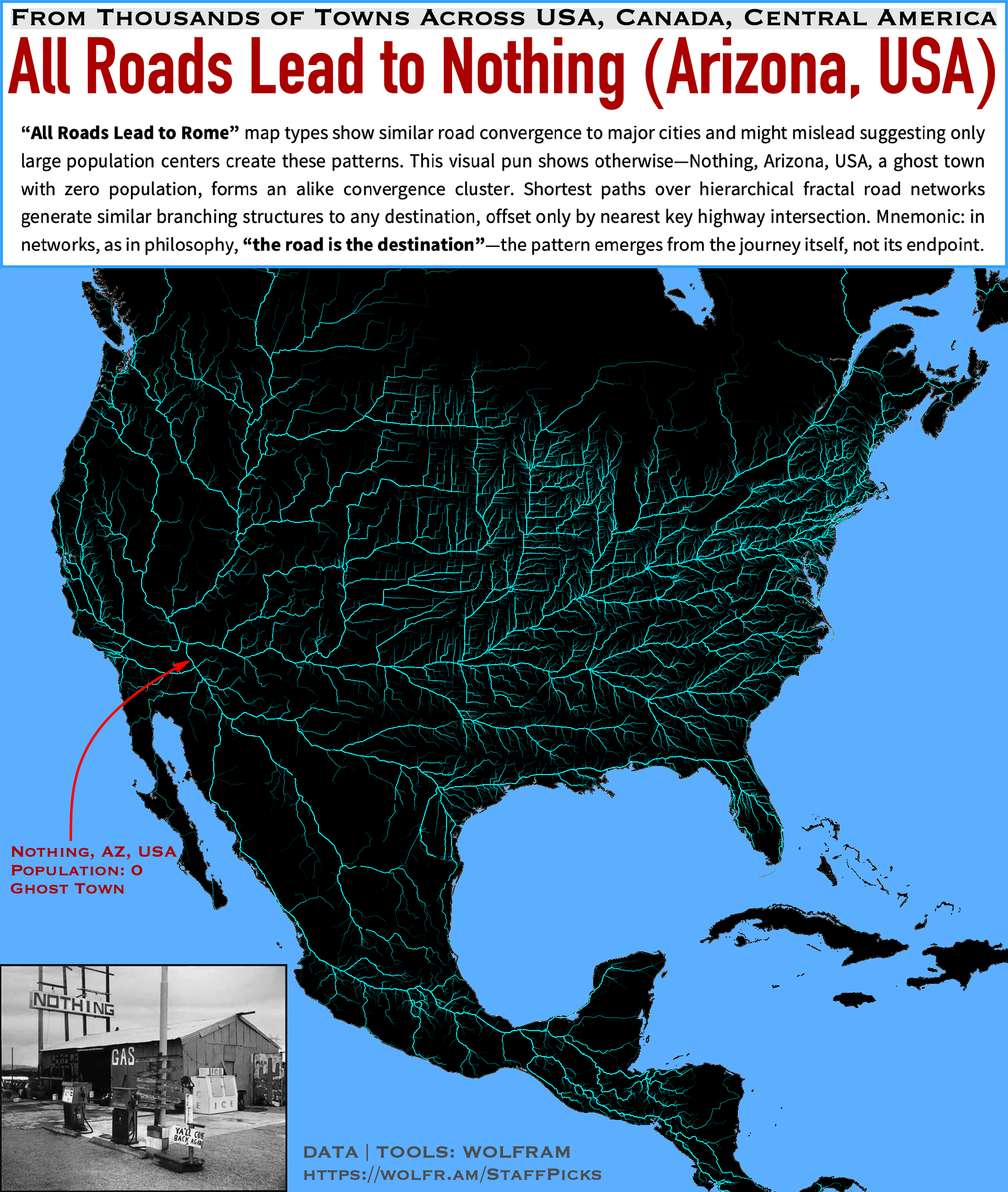
I computed the shortest routes from all 37,000 cities and towns across the US, Canada, and Central America, all converging on Nothing, Arizona — a ghost town with zero population. Despite the lack of a major urban center, the map still shows pronounced clustering, illustrating how hierarchical, fractal-like road networks naturally funnel routes onto key highways. I generated multiple randomized samples of paths and combined them, emphasizing the persistent branching effect that echoes “All Roads Lead to Rome.” Yet here, the real takeaway is that the journey itself defines the pattern, no matter where you end up, even in zero-population places.
losark on
All those incredibly long and straight roads in the mid west…
aureliaan on
Very cool!
Can you do one of Europe?
Tha_Funky_Homosapien on
Aka, the fastest routes out of Nothing, AZ.
denadena2929 on
It’s funny, looking at this you’d think Nothing, AZ was some sort of super important hub with all road networks branching from it, when the truth is quite the opposite.
Y-27632 on
I’m confused as to what this is meant to demonstrate. (Or, frankly, how it shows that the pattern doesn’t depend on the endpoint, or what “the road is the destination” is supposed to mean.) Is it that instead of having it calculate from Nothing, AZ to all the 37,000 places, it was done in reverse, and you still got the same kind of fractal pattern?
There’s only one shortest path between two points on a road network (for a given level of detail) so what’s surprising about this?
Am I just missing something?
Also, what do the thicker lines indicate, larger roads or roads more heavily used? And to what degree do those things correlate?
Atzkicica on
Huh, now you can’t even see Nothing. Big pile of I guess road building stone in front of it. But if you jump in the U-Turn lane on streetview it goes back to 2021 and you can kinda see it.

![[OC] All roads lead to Nothing (Arizona, USA) -- Fractal shortest paths in road networks](https://www.byteseu.com/wp-content/uploads/2025/03/aqby9knrceme1-1299x1536.png "[OC] All roads lead to Nothing (Arizona, USA) — Fractal shortest paths in road networks")
7 Comments
TOOLS: Wolfram Language
DATA: Wolfram|Alpha
Article with code and details of the visualization:
[https://community.wolfram.com/groups/-/m/t/3403335](https://community.wolfram.com/groups/-/m/t/3403335)
I computed the shortest routes from all 37,000 cities and towns across the US, Canada, and Central America, all converging on Nothing, Arizona — a ghost town with zero population. Despite the lack of a major urban center, the map still shows pronounced clustering, illustrating how hierarchical, fractal-like road networks naturally funnel routes onto key highways. I generated multiple randomized samples of paths and combined them, emphasizing the persistent branching effect that echoes “All Roads Lead to Rome.” Yet here, the real takeaway is that the journey itself defines the pattern, no matter where you end up, even in zero-population places.
All those incredibly long and straight roads in the mid west…
Very cool!
Can you do one of Europe?
Aka, the fastest routes out of Nothing, AZ.
It’s funny, looking at this you’d think Nothing, AZ was some sort of super important hub with all road networks branching from it, when the truth is quite the opposite.
I’m confused as to what this is meant to demonstrate. (Or, frankly, how it shows that the pattern doesn’t depend on the endpoint, or what “the road is the destination” is supposed to mean.) Is it that instead of having it calculate from Nothing, AZ to all the 37,000 places, it was done in reverse, and you still got the same kind of fractal pattern?
There’s only one shortest path between two points on a road network (for a given level of detail) so what’s surprising about this?
Am I just missing something?
Also, what do the thicker lines indicate, larger roads or roads more heavily used? And to what degree do those things correlate?
Huh, now you can’t even see Nothing. Big pile of I guess road building stone in front of it. But if you jump in the U-Turn lane on streetview it goes back to 2021 and you can kinda see it.