Share Facebook Twitter LinkedIn Pinterest Bluesky Threads Created by me over years of tracking using mapchart and Google maps. Posted by DiabolicDiabetik
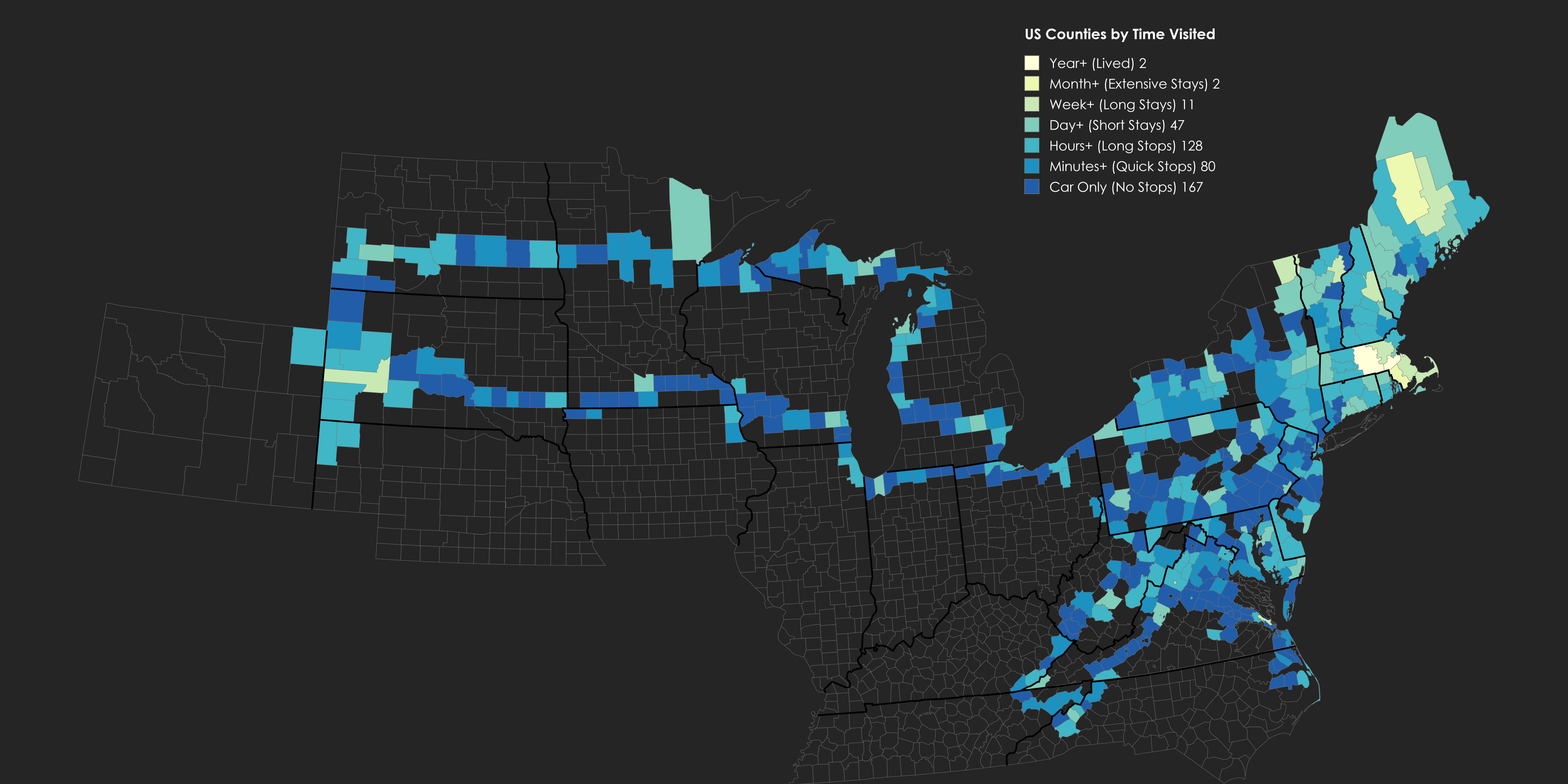
DiabolicDiabetik on March 3, 2025 11:59 am I created this graphic using mapchart, and use Google maps to track counties whenever I travel. It’s something I am constantly updating over the years as I go new places.

![[OC] US Counties I've Visited (By Time)](https://www.byteseu.com/wp-content/uploads/2025/03/jxj1mom1sgme1-1536x768.png "[OC] US Counties I’ve Visited (By Time)")
4 Comments
I created this graphic using mapchart, and use Google maps to track counties whenever I travel. It’s something I am constantly updating over the years as I go new places.
That happens if you only go for the main quest.
Gerrymandering is getting out of hand.
Thought this was a gerrymandered district